
3D Mapping, Surveying & GIS Solutions

Easy. Accurate. Versatile.

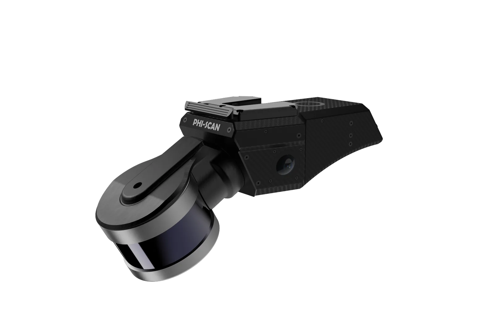
LiDAR scanning technology delivers an invaluable tool for industries requiring high-precision, real-time and comprehensive data collection in diverse and challenging environments.

  • 200m LiDAR range
  • 360°×280° Field of view
  • 600K Points / sec
  • 16 LiDAR channels
Phi-Scan LiDAR scanner

FEATURES

INDUSTRIES

Empowering Industries With Survey-Grade 3D Maps

3D mapping that helps teams plan, build, and maintain with trusted 3D ground truth, ensuring compliance.

railway track point cloud
01 / 04

ROAD AND RAILWAY

Engineer safer roads and railways using measurable, auditable 3D data.

Capture corridor data at speed and precision to cut closures and cost, improve safety, and accelerate design, maintenance, and compliance.

  • Corridor Planning & Design
  • Track/Roadway Inspection & Maintenance
  • Condition Monitoring & Right-of-Way Surveillance
  • Safety Audits, Risk & Clearance Analysis
Schedule a demo
construction point cloud
02 / 04

CONSTRUCTION & ENGINEERING

Build smarter with survey-grade LiDAR.

Turn jobsites into verifiable 3D data for faster coordination, safer installs, and audit-ready handover. Capture as-builts, track progress, and check tolerances to cut rework and stay on time and budget.

  • Progress tracking: measure percent complete against plan
  • Earthworks & volumes: cut/fill analysis and stockpiles
  • Safety & hazards: clearances and exclusion zones
  • Documentation & compliance: records for handover and claims
Schedule a demo
tunnel point cloud
03 / 04

TUNNEL AND MINING

Reliable 3D mapping for safer tunnels and mines.

High-resolution underground mapping that speeds surveys, reduces exposure and optimizes planning.

  • Structural monitoring: convergence, deformation, and lining condition
  • Volume calculation: stopes, stockpiles, cut/fill, backfill reconciliation
  • Automation & machine guidance: alignment, clearance, and heading control
  • Safety & hazard assessment: overbreak/underbreak, rockfall risk and access checks
Schedule a demo
forestry point cloud
04 / 04

FORESTRY

Data-driven forestry for sustainable management and research.

High-resolution LiDAR turns complex canopies into decision-ready data for sustainable management, conservation, and ecological research.

  • Tree metrics (DBH): per-tree diameter measurement
  • Accurate tree counts: stand and plot inventories
  • Biomass & carbon: estimation for planning and reporting
  • Digital Terrain Model (DTM): bare-earth elevation beneath canopy
Schedule a demo

CHOOSE YOUR SYSTEM

Why Phi-Scan?

LiDAR scanning technology delivers an invaluable tool for industries requiring high-precision, real-time, and comprehensive data collection in diverse and challenging environments.

  • ±5mm Isolated change detection
  • 600Kpts/s Dual return acquisition
  • 8hrs Of sensor data on 512 GB
  • 1.8kg Total system weight

REACH OUT

Get Started On Your LiDAR Journey. Contact Us Now!

Get Ahead of a Demo Today

  • Email contact@phicode.io
  • Location Bhuvanappa Layout, Tavarekere Main Rd.
    Bengaluru, Karnataka 560029